Buffalo Township
|
Buffalo township is situated in the eastern portion
of Pike County, directly north of Calumet township. The Salt River divides it on
the north from Salt River township; the Mississippi River extends its length on
the east, and Cuivre and Peno townships border it on the west. Its topography is
similar to that of Calumet Township with breathtaking views of the Mississippi
River on the east and foothills and bluffs on the north and south. The land is
fertile and excellent for grazing and grain. Where once tobacco and apples were
the main products, in the 1990's corn, soybeans, and wheat dominate the fields
of flourishing farmlands; and at harvest time, farm trucks line the highway
leading to the grain terminal located at the south end of Louisiana.
The Salt River, the Noix, Buffalo, Sugar, Grassy and Clear Creeks offer excellent water supplies. Tow constantly flowing sub-soil streams near Louisiana have been made into parklands where the stream is partially diverted into free flowing pipes. Passers-by once used these streams for hauling sparkling water to their homes for drinking and the making of tea and coffee. A sad commentary on our times are signs at these beautiful spots, one of which is alongside Highway 79, warning the passer-by that the water in no longer fit for human consumption. Stone and lumber were once important products of this area, and limestone is still quarried in parts of Buffalo township, but tobacco was the principal product of the 19th century. Only an occasional tobacco shed in tentative condition remains to reflect that once booming industry. Buffalo township's history began in 1690 when the French explorer, Robert Cavalier de La Salle navigated his way from the Great Lakes down to the mouth of the Mississippi River. At one crossing in this area, he found his way blocked by enormous herds of buffalo. When settlers came to this area 125 years later, the Indians told of a great snow which inundated the Midwest with snow and ice so deep that buffalo and elk herds reportedly starved to death. Tell-tale bones still testify to the numerous amount of these animals. The abundance of buffalo left its mark with the names of the township, streams, hills, churches and even schools in the area. In a lovely cemetery on the southern slope of the bluff known as Buffalo Knob overlooking the Mississippi south of Louisiana, is buried a relative of the American poet, Ralph Waldo Emerson. Just below this burial ground was once a thriving wharf with pens for the livestock and sacked grain waiting for the packet boats to ship them down the river to St. Louis. This wharf was known as "Crider Steamboat Landing". In 1981 the Hercules, Inc. plant occupied part of this area. The towns in Buffalo township are dominated by Louisiana, by far the largest in the county. But other small settlements which played out their importance in the 1800's are Bryson, McIntosh, Reading Station and Stark.
A post office was established in Bryson, located in northern Buffalo township, in 1899 but it was discontinued in 1901. The area was named for John Bryson, an early settler who came to the county from South Carolina in 1816 and settled on Buffalo Creek. He was the first Justice of the Peace in the county, being appointed by Governor Clark of the Missouri Territory in 1819.
Louisiana, situated on the Mississippi River, is 70 miles north of St. Louis on Route 79 and is about 30 miles south of Hannibal, Missouri. It was called "Land of the Golden Hills" by the early French explorers. The first settlers made their homes here in 1808. Today, like the early settlers many find Louisiana offers a quiet, peaceful atmosphere for raising a family and operation a business. The State Department of Natural Resources has said Louisiana has "the most intact Victorian Streetscape in the state of Missouri". Georgia Street Historic District has over 54 buildings in the downtown. The architectural styles are predominately Italianate or Victorian It is a city of historic home (dating from the early 1800s), many are listed on the National Register of Historic Places. Its population, once touted as "bound to reach 20,000 in the 19th century", does not even match the zenith of 1880, which was almost 7,000 people. In the 1990's there are approximately 4,000 residents. Louisiana's first settler was John Bryson, who arrived from South Carolina via St. Louis, to claim title to a quarter section of land. In 1817 he built the town's first residence on what is now Ninth Street between Georgia and Tennessee. While the home no longer stands, there is a marker to denote the site. In 1818 Bryson sold some of the river-front land to Joel Shaw and Samuel Caldwell of Kentucky, and the tract was laid out in lots. This area became the original plat of Louisiana. The town was laid out by James Jones, the first surveyor of the county. There are several theories as to how the town received its name. The 1883 "History of Pike County" states most assuredly "the town was named for the state of Louisiana, and not after the beautiful face of some mythical Louise, as many have imagined." "Louise" may have been the same person referred to in the legion that that the town was named for a girl who was born in St. Louis just as the French flag for the territory was taken down and the American flag erected following the Louisiana Purchase of 1803. Still others contend that the name was chosen to commemorate the Louisiana Purchase itself. In any event, the town was so named, and became the temporary county seat for Pike County from 1818 until Bowling Green was officially named to that honor in 1822. While Louisiana was serving as the county seat, the circuit court was held in the town tavern (hotel) owned by Obadiah Dickinson. A log jail house was constructed close by and eventually a brick building was erected as a temporary courthouse. By 1835 Louisiana began to assume the appearance of a thrifty business town, grading down hills, opening up some of the principle streets and establishing a levee against the encroaching river. This pattern of growth zoomed to its zenith in the late 1800's and then began its decline. Once the center market for area produce, Louisiana was deeply affected by the expansion of railroads which made it easy to by-pass the town for the greater markets of St. Louis and Chicago. Subsequently, the town never reached the vaunted 20,000 population and indeed, decreased in size in each decade following 1880 for a full century. Before, during and after the railroad's introduction, Louisiana remained dependent on the river. The Hercules, Inc. Company, located on the southern border of Louisiana, employs several hundred citizens and uses the river for shipping and cooling. The Nord-Buffum Button Factory which operated through-out the first half of the 20th century, depended on the pearl-like mussel shells found in the river for their buttons. Several Louisiana businesses rely on the river for shipping their goods and grain to markets outside of Pike County. And the town has become recreationally minded with pleasure-boating a popular pastime in the 1980's with a modern boat marina located just across the river from Louisiana in Illinois. The diesel-driven barges still whistle a hoarse-voiced reminder of the days when Samuel Clemens (Mark Twain) piloted steamboats along the Mississippi[ past Pike County. At the same time that Bryson, Shaw and Caldwell were developing the town of Louisiana near the river, Judge James Hart Stark was starting a nursery at the western end of town. He brought his scions with him from Kentucky and grafted them onto native crabapple trees. From this humble beginning grew Stark Bro.'s Nurseries and Orchards Company, still a flourishing business located in Louisiana in 1981, still operated by descendants of the Stark family, and now the largest mail-order nursery in the world. In the 1980's, there are several lovely parks in Louisiana. Riverview Park (also known as Henderson Park) is located on the crest of Main Street with a commanding view of the river and the Champ Clark Bridge. Sunset Park, the largest park in town, is one city block long, located on Georgia Street near the Pike County Memorial Hospital at 22nd Street. It was built in 1927. A third park is located near the Louisiana Primary School and public pool, at the corner of Kentucky Street and Wells Lane. Louisiana is also the home of the Pike County Memorial Hospital, an 80-bed facility located on Georgia Street, constructed in 1972. The original Pike County Hospital, now the site of Smith-Barr Manor Nursing Home, was built in 1928. The Twin Pikes Shopping Center, on the western edge of town along Georgia Street, houses several Louisiana businesses and restaurants with Wal-Mart and Kroger supermarket as its anchor stores in 1981. The shopping center was constructed in 1976. While Louisiana's population has continued to dwindle in the past 100 years, it is now comparatively stable and the decline was less than 300 people in the decade from 1970 to 1980 according to census figures.
McIntosh, now a whistle-stop on the Burlington Railroad, once was a place where mail and telegraphy marked its station. In the 1980's, the station is gone, but the majestic hill which bears it name (alongside Highway 79 between Clarksville and Louisiana) has one of the most scenic views in Pike County. Looking down through the trees atop McIntosh Hill, one can see chains of hills with the Mississippi River nestling beside them for miles.
Reading Station, still listed on plat maps of Pike County, is located in northern Buffalo township. It once had a station for the Chicago, Burlington and Quincy Railroad, located about three miles southwest of the Reading Post Office. In that vicinity were several homes and a store. The small community of Reading has slowly faded away over the years.
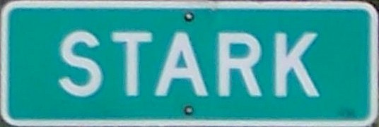
Stark, once known as Starkdale, came into being when Stark Bro.'s Nurseries and Orchards Company leased the land in that area for the propagation of nursery stocks. The land at that time was owned by Fieldon Estes and was known as the "Coles Tract". The town of Starkdale in its zenith at the turn of the century had a general store, a school and about 100 families. A post office operated at that location from 1889 until 1904 and there was also a railroad station. The town was reputedly named for Thomas Thorton Stark, who owned the land on which it was located. On December 9, 1902, there was a public sale at Starkdale to auction off the acreage which was in the estate of the late Fieldon Estes. The land in this vicinity sold at that time for anywhere from $35 to $55 per acre. About all that was left in Stark in 1981 was a highway sign alongside Highway D designating where the town begins and several architecturally significant homes (some of the ante-bellum period) which reflect the glamour of a by-gone era.
|

|
Cemetery Information |
||
|
|
||
|
|
|
|
|
|
|
|
|
|
|
|
|
|
|
|
|